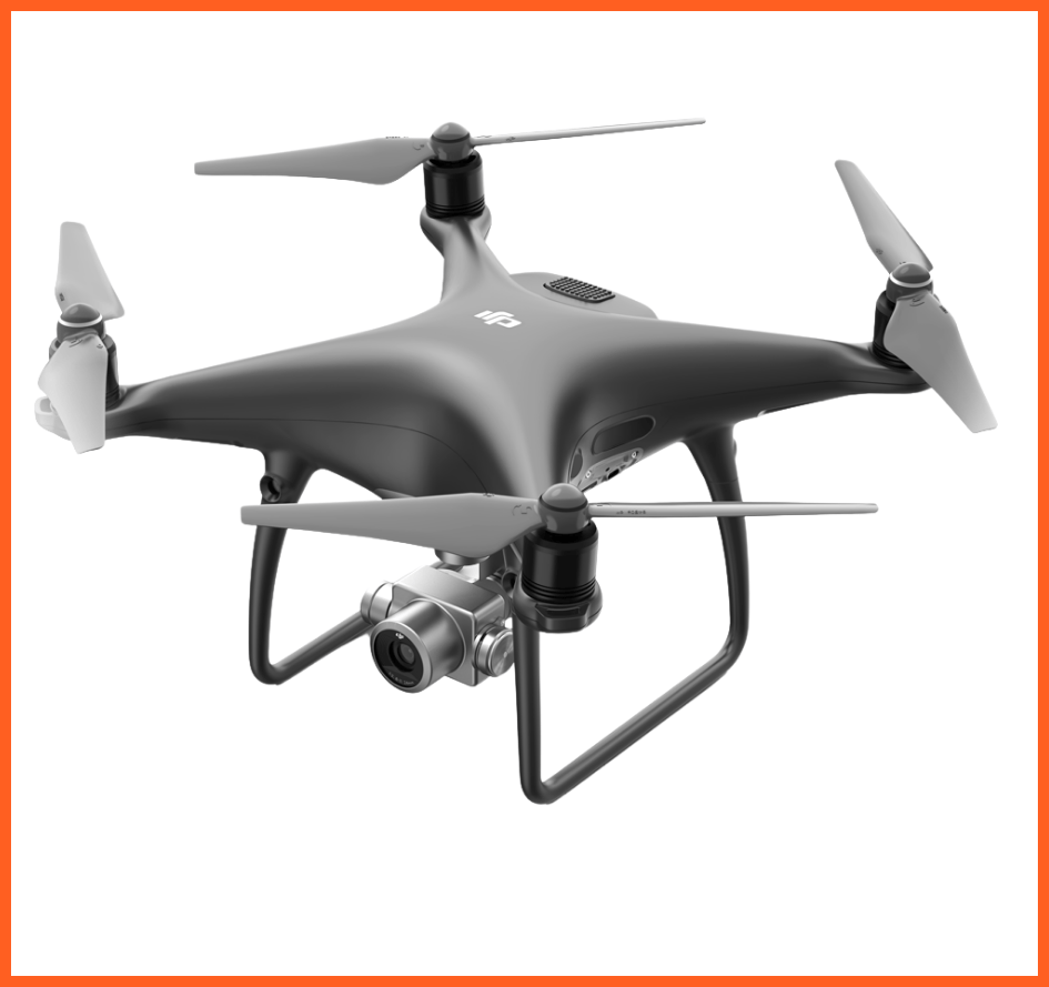
The DJI Phantom 4 Pro is a high-precision camera drone with a 1-inch, 20MP sensor. It's ideal for aerial photography and filming, capturing smooth 4K video at 60 fps with excellent flight stability and obstacle avoidance.
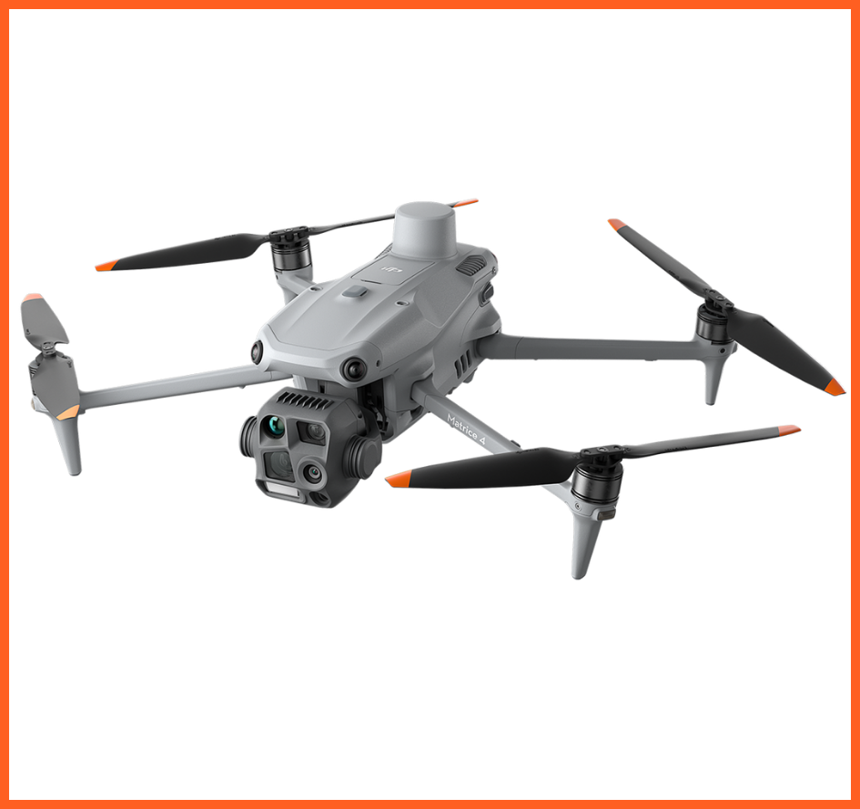
DJI Matrice 4T – High-Precision Industrial Drone. With its thermal, zoom, and wide-angle cameras, the Matrice 4T is perfect for surveillance, mapping, and emergency operations. Its durable design and long flight time ensure reliable performance in any setting.
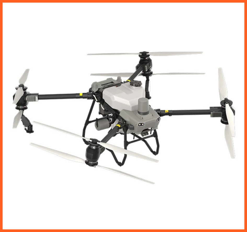
The DJI Agras T50 is a high-capacity agricultural drone equipped with a 50 kg spraying tank and advanced flight control for efficient crop protection. It operates on automated routes, even in challenging terrain.
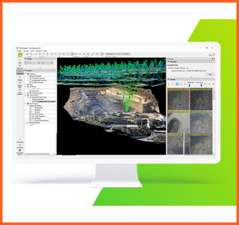
PIX4D mapper is an advanced photogrammetry software that generates accurate 3D models and maps from drone imagery. It is ideal for engineering surveys, construction projects, and topographic applications.
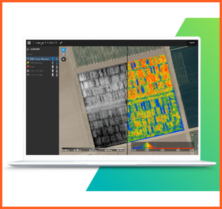
PIX4D fields is a dedicated agricultural mapping software designed for fast and accurate NDVI analysis, zone maps, and yield optimization, tailored for use directly in the field.
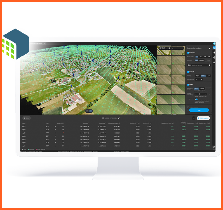
DJI Terra is a professional mapping software that enables fast processing of 2D and 3D models, orthomosaics, and point clouds. It is especially effective for industrial surveys, construction documentation, and site analysis.
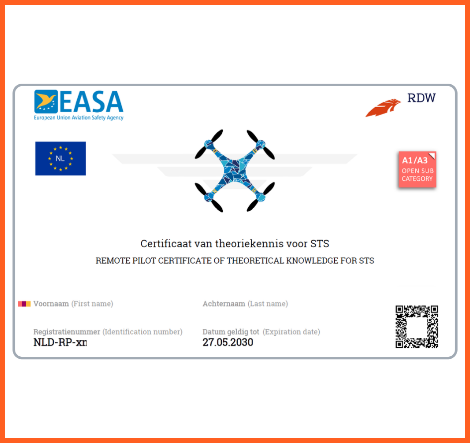
The A1–A3 drone certificate verifies basic theoretical knowledge for the responsible use of lightweight drones in the open category. It allows flight near populated areas in low-risk environments.
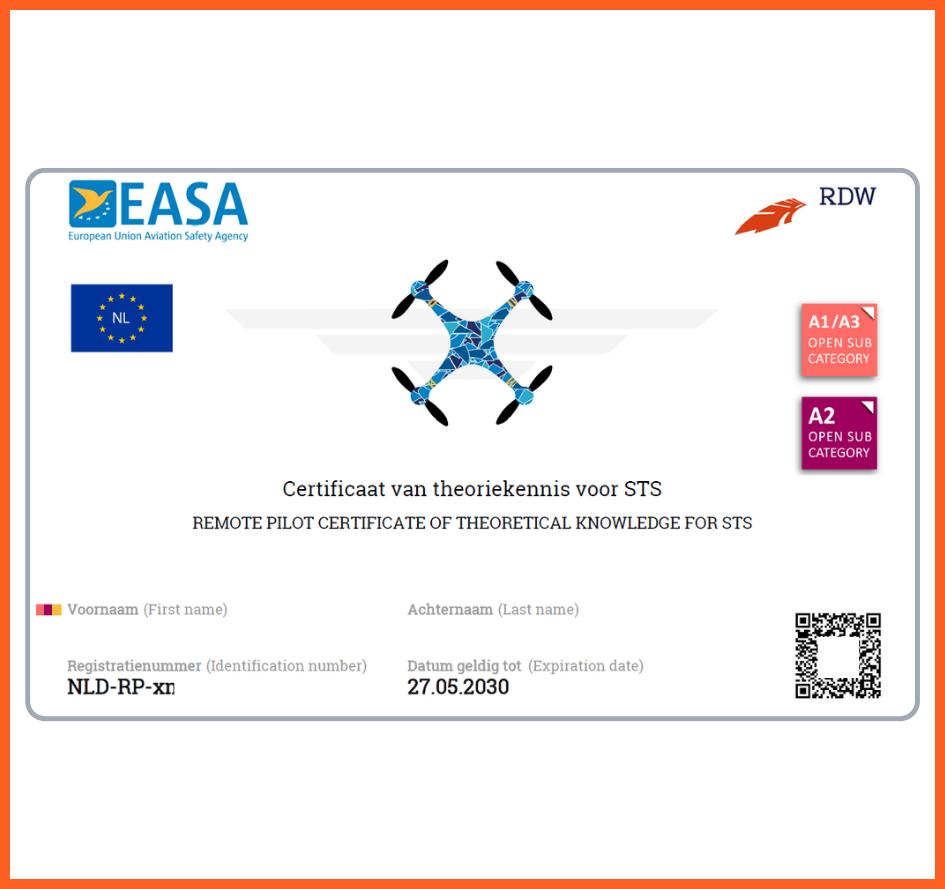
The A2 certificate extends open category rights, allowing medium-weight drones to operate near populated areas under stricter safety conditions. It also requires self-practical training.
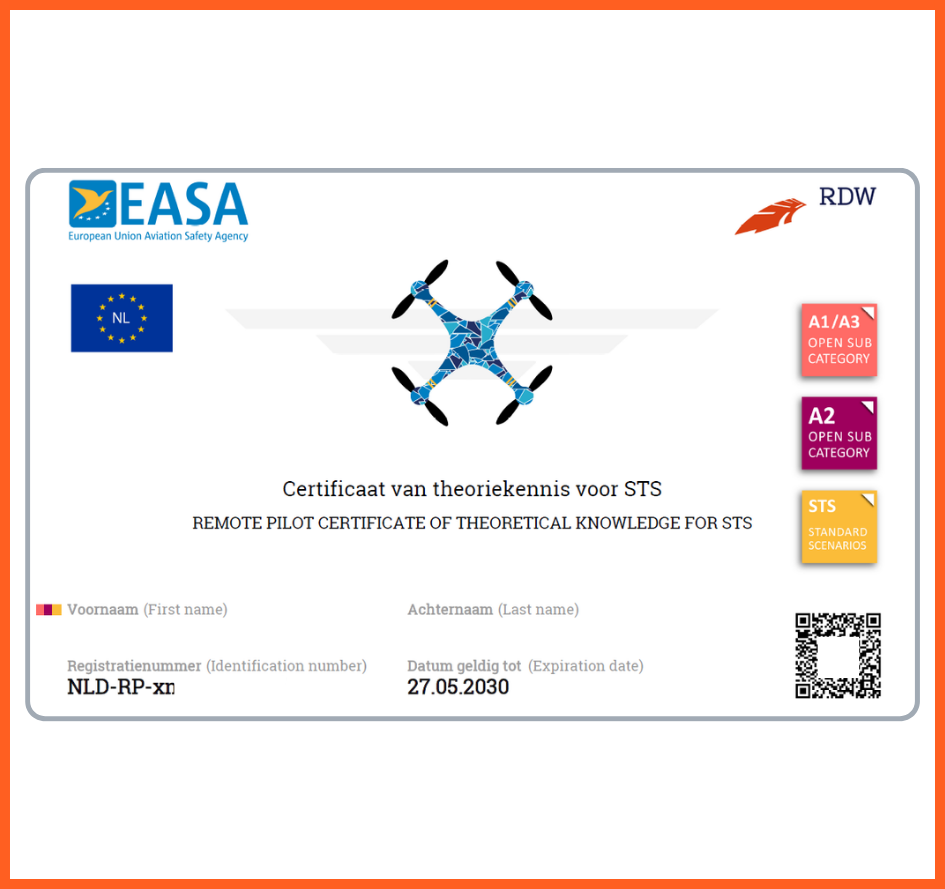
The STS certificate is required for special category operations in more complex environments. It requires a higher level of training and a licence, such as flights in urban, industrial or agricultural spray areas.
Our Work flow Step by Step
Every project is guided by careful planning, cutting-edge technology, and a personalized approach—from first contact to final delivery.
Start a projectTell us about your vision, and we’ll help you find the best drone solution.
Book a time, and we’ll arrange your on-site drone shoot.
Our skilled pilots operate on site with precision and safety.